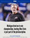
Tom Izzo spoke out against the NCAA after former NBA draft pick James Nnaji’s commitment to Baylor

www.si.com
Tom Izzo Rips NCAA Over Former NBA Draft Pick Committing to Baylor
James Nnaji the 31st pick in the 2023 NBA draft, recently committed to play for Scott Drew and Baylor.
In the ever-changing landscape of college sports, another seismic shift came recently with the news of former NBA draft pick James Nnaji’s commitment to Baylor. Nnaji, the 31st pick in the 2023 NBA draft, has played in Europe since he was drafted and the Knicks currently own his draft rights.
He has never appeared in an NBA game, but taking the college route sparks an immediate question about the harsh reality of college sports in the modern age. Michigan State coach Tom Izzo hasn’t been afraid to criticize the NCAA in its new age of NIL, most recently for the decision to grant eligibility to multiple former NBA G League players to play college basketball. The legendary Spartans coach always sticks up for the integrity of the game and especially its players. He was asked about Nnaji’s commitment and provided some candid thoughts for the NCAA to chew on.
“Now we’re taking guys that were drafted in the NBA and everything,” Izzo said via
Spartans Illustrated. “I said it to you a month and a half ago, come on Magic [Johnson] and Gary [Harris], let’s go baby. Let’s do it, why not? If that’s what we’re going through, shame on the NCAA. Shame on the coaches too, but shame on the NCAA. Because coaches are going to do what they got to do I guess, but the NCAA is the one.
“Those people on those committees that are making those decisions to allow something so ridiculous and not think of the kid. Everybody talks about me thinking about my program as selfish, no. Get that straight for all of you, I’m thinking of what is best for my son if he was in that position. And I just don’t agree with it.”
Login to view embedded media
,
,
,
continued
The combination of schools looking for players outside the traditional recruiting realm and judges eroding the NCAA’s ability to enforce eligibility rules has led everyone here, whether they like it or not.

sports.yahoo.com
'This s*** is crazy' — Baylor's addition of James Nnaji further blurs line between pro and college hoops
It’s rare for a college basketball story to enter the mainstream sports conversation on Christmas Eve, but Baylor’s announcement that it had added center James Nnaji — the 31st pick in the 2023 NBA Draft — was enough of a “What are we doing here?” moment for it to break through.
Though college sports is now professional in almost every sense — including players who have signed pro contracts in Europe and the NBA G League finding their way to college basketball this year — the Nnaji development feels like new territory. This isn’t someone who slipped through the cracks or got bad advice, turned pro out of high school and ran into a career dead end. Nnaji, who has been playing in Europe, was one draft slot away from being a first-round pick with a guaranteed NBA contract. He played in the NBA Summer League and has even been part of a trade.
“Santa Claus is delivering mid season acquisitions…this s*** is crazy!!” UConn coach Dan Hurley wrote on X shortly after the news became public.
Is this really the type of player who should be part of college basketball? Who knows, maybe Arizona can get LeBron James on the bench for its Final Four push if he wants to play with his son Bryce....

That would be absurd, of course — and, to be clear, expressly against NCAA rules since these pro-to-college cases must take place within five years of high school — but you can be forgiven if it seems like anything goes these days.
And guess what? As more college programs pursue mid-year additions, some have even checked in with G League players on two-way contracts who have appeared in actual NBA games. That seems inevitable at some point, too, given where this trend seems to be headed.
But don’t blame Baylor or any program for pursuing those players.
While you’d be hard-pressed to find anyone in college sports who thinks this is a good development, schools are merely doing what the NCAA has given them the green light to do as it waits and hopes for some kind of antitrust protection from Congress that would allow for the actual enforcement of the rulebook rather than a mishmash of eligibility rulings.
.
.
.
continued
Just sayin': Who knew that you could get drafted by the NBA, play professionally in Europe, and then still be eligible to play college basketball? He's listed (below) on Baylor's roster as a Freshman:


