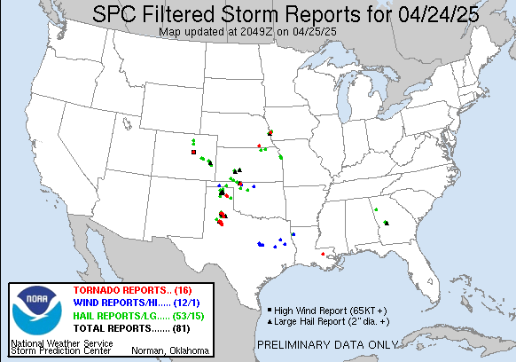
I don't know if anyone lives near/in OKC but it's about to get interesting here...
Storm Prediction Center PDS Tornado Watch 146
Severe weather, tornado, thunderstorm, fire weather, storm report, tornado watch, severe thunderstorm watch, mesoscale discussion, convective outlook products from the Storm Prediction Center.
www.spc.noaa.gov
URGENT - IMMEDIATE BROADCAST REQUESTED
Tornado Watch Number 146
NWS Storm Prediction Center Norman OK
1240 PM CDT Sat Apr 27 2024
The NWS Storm Prediction Center has issued a
* Tornado Watch for portions of
Western Oklahoma
Northwest Texas
* Effective this Saturday afternoon and evening from 1240 PM
until 800 PM CDT.
...THIS IS A PARTICULARLY DANGEROUS SITUATION...
* Primary threats include...
Several tornadoes and a few intense tornadoes likely
Widespread large hail and scattered very large hail events to 3
inches in diameter likely
Widespread damaging winds and isolated significant gusts to 75
mph likely
SUMMARY...Intense thunderstorms are expected to develop this
afternoon along and east of a dryline over western Oklahoma and
northwest Texas. Supercells are expected, capable of very large
hail and damaging winds. The most intense cells may also produce
strong or potentially long-tracked tornadoes.
The tornado watch area is approximately along and 70 statute miles
east and west of a line from 35 miles east northeast of Alva OK to
45 miles southwest of Wichita Falls TX. For a complete depiction of
the watch see the associated watch outline update (WOUS64 KWNS
WOU6).
Upvote
0


